SRWMD & FEMA Will Be On Hand To Discuss Flood Map Updates: A $14 Million Project & Counting
Worried about flooding? The public has a chance to speak directly with engineers and high government officials.
Posted February 20, 2023 3:55 pm

Photo: water via Adobe; Chief Engineer Leroy
Marshall by the Observer
COLUMBIA COUNTY, FL – Beginning tomorrow evening, February 21, and continuing on the following two evenings, the Suwannee River Water Management District will be meeting and inviting the public to discuss updated flood risk maps for the Santa Fe Watershed.
$14 Million & Counting
According to figures obtained from the Water Management District, since 2014, FEMA has provided approximately $12,386,417 in funding that would be utilized for updated flood maps, associated project management, and outreach activities. Costs associated with the Santa Fe Watershed Flood Risk Review Study amounted to approximately $1.8 million in federal funding.
A project summary for each basin, dated November 2021, has been provided by the District. Financial figures are not included.
The District encourages local property owners to provide feedback on their property’s flood status.
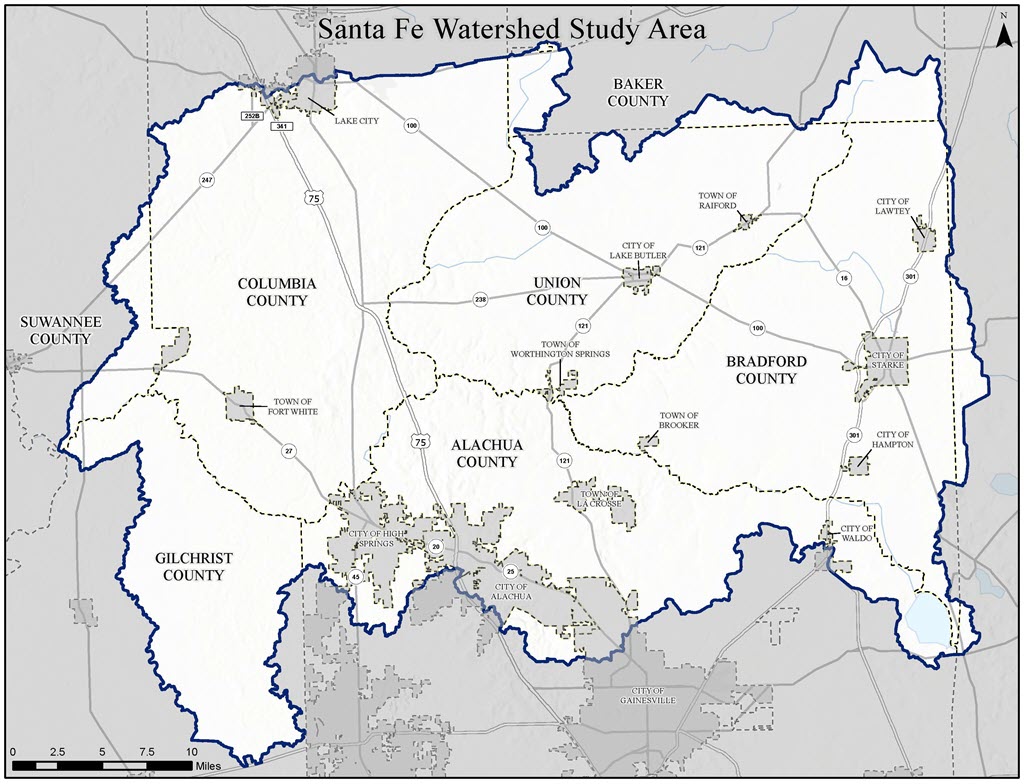
What is the Santa Fe River Basin?
 The
Santa Fe River Basin is a watershed centered
around the Santa Fe, Ichetucknee and New
Rivers, and Olustee Creek. The Santa Fe
River Basin spans nine counties, including
parts of Alachua, Gilchrist, Suwannee,
Columbia, Union, Bradford, Baker, Clay, and
Putnam.
The
Santa Fe River Basin is a watershed centered
around the Santa Fe, Ichetucknee and New
Rivers, and Olustee Creek. The Santa Fe
River Basin spans nine counties, including
parts of Alachua, Gilchrist, Suwannee,
Columbia, Union, Bradford, Baker, Clay, and
Putnam.
The basin is an important recharge area for the Floridan Aquifer and is a tributary basin to the Suwannee River, which flows directly to the Gulf of Mexico. In addition to the basin's regional importance for water quality and as a critical space for wildlife, this area is well known as a recreation area for swimming, fishing, kayaking, and tubing the Ichetucknee and Santa Fe rivers.
The watershed is approximately 1,380 square miles and spreads across southern Columbia, southern Suwannee, western Bradford, far southern Baker, Union, northern and eastern Gilchrist, and northern Alachua counties.
Residents looking for information on the status of their property or any other property, and any proposed changes can visit the online web map and search by address.
The map is packed with information, but it will take some time to understand. Clicking on the three menu lines at the top of the map will enable one to get to the legend. The other links will provide a layer list, parcels, and additional information.
Residents can also visit the virtual meeting room for additional information.
The District encourages residents to search for their property to find any changes since the last flood maps. District and FEMA representatives will be on hand at community meetings to answer your questions.
Those unable to attend or that have questions can submit feedback at this link for up to 30 days after the meetings.
Three public meetings have been scheduled for residents and the public to provide feedback and ask questions.
• February 21 – Bradford County Courthouse in Starke – 5 p.m. to 8 p.m.
• February 22 – James A. Lewis Commission Chambers in Alachua – 5 p.m. to 8 p.m.
• February 23 – Westside Community Center in Lake City – 5 p.m. to 8 p.m.
Flood Protection: A Big Part of the District Strategic Plan
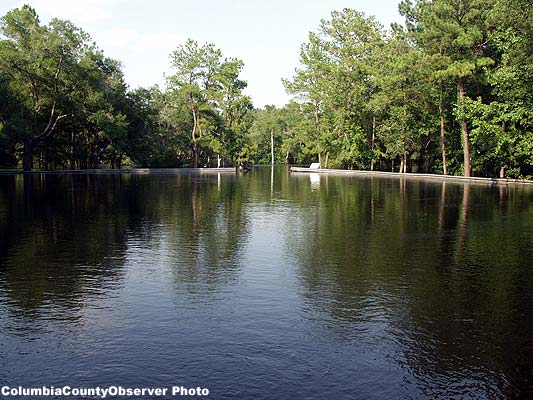
Flooding on the Santa Fe
2012;
By Saturday afternoon one could have gone boating in the
parking lot.
The Suwannee River Water Management District works with the Florida Department of Transportation (FDOT), Florida Division of Emergency Management (FDEM), local governments, and landowners to implement regional and local flood protection and flood control projects.
The District also provides information to the public to reduce and mitigate flood risks. The District partners with Federal Emergency Management Agency (FEMA) to update floodplain maps which helps the public make informed decisions that reduce risk to life and property.
The District is the primary source of current flooding information for other agencies and the public, including real-time river levels and rainfall amounts, so that people can make well-informed decisions about flood protection and property at risk.
Through the Environmental Resource Permitting (ERP) Program, the District ensures that development does not result in flooding. Permit reviews are performed to prevent net loss of the 100-year floodplain or increases in flood levels. Permit evaluations also consider storm design conditions and potential impacts on upstream and downstream properties.
Epilogue
With Florida's property insurance rates
heading skyward, climate change, and the
area's propensity to flood, attending one of
the meetings may be a good idea.